Earlier this year I was asked to contribute to Watershed’s Open Cities strand in Guimarães, Portugal, one of the 2012 European Cities of Culture. I proposed two workshops based on open mapping, and the first of these took place this week.
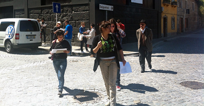
I started the day with a presentation on maps, focussing particularly on issues of copyright and ownership, introducing the group to Open Street Map and Walking Papers. Then we went out walking. The presentation, embedded above, covered some of my own work involved in maps, such as Rorschmap, Robot Flaneur, Where the F**K Was I? and A Ship Adrift.
I talked about how many maps are products, belonging to governments and corporations (such as the UK’s Ordnance Survey – a map designed for bombing things – or Google), and the distorting effect this has on our perceptions and agency. Even the GPS network which we increasingly rely on is subservient to national defence issues: my friend Jim grew up in Slovenia, learning to sail the old way because GPS was shut down for much of the region during the Balkan wars.
Maps also have a tendency to become history: I used the particular example of the lower Lea Valley which, despite a rich history, an emplaced population and a variety of rare wildlife, appeared as bare wasteland on most maps pre-Olympics. This allowed it to be traduced, maligned and ultimately destroyed. (The Olympic Branding Exclusion Zone is a further cartographic blight on the area.)
There is an alternative to corporate and governmental maps: maps made by people, particularly open maps like Open Street Map – open in the sense of bottom-up, community-made, like Wikipedia, and openly licensed, available for anyone to use.
Open maps allow for may helpful and vital uses, from offline maps and redesignable maps, to historical cross-referencing and data exploration and crisis mapping.
Guimarães has some representation on OSM, but it doesn’t come close to an actual map of the city – and neither do many of the competitors. As such, it’s a brilliant opportunity for learning about and contributing to a truly citizen-owned map of the city.
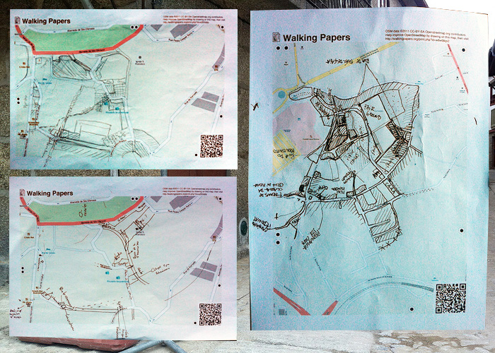
I explained the workings of Walking Papers, by Mike Migurski at Stamen, which close the loop between on-the-street mapping with paper and pens, and the digital map online. Walking Papers allow anyone to print out sections of the map, draw directly on them, and re-upload them, where they are automatically placed for tracing in the correct position. The truth on the ground, as the cartographers say.
I’d done a little mapping of the historical centre’s alleyways over the weekend, and I set the group the challenge of improving the maps of two areas of the city, around CAA, where the workshop was taking place, and around the Couros district, a former industrial area earmarked for regeneration. In particular, I challenged them to think about how the map would represent local, culturally unique structures, such as the communal laundries along the river, and the old tannery pits of Couros. At present, the map has no obvious categories for these, and finding how to represent them is a demonstration of the open maps flexibilities, as well as forming a valuable historical record of these vernacular, often-overlooked structures. Abandoned buildings are a particular problem in Guimarães—as they are across much of Portugal, due to convoluted and occasionally corrupt ownership disputes—and building a detailed map of these would be of immense value.

We mapped for about an hour in the morning, and then returned to edit the map, and have lunch.
In the afternoon, I gave a brief overview of some other, more artistic uses of maps and mapping, to stimulate other responses to the work. The work of Mike Migurski and the rest of Stamen, as well as that of Aaron Straup Cope, was a big influence here, so they got as much credit as I could give.
Examples include: [building=yes], airport city, The Spinny Bar Historical Society, Prettymaps, Watercolor maps, emotion mapping, wifi light painting, Hackney Hear, Tracks on a Map, hand-drawn maps, and the best of imaginary and fictional maps.
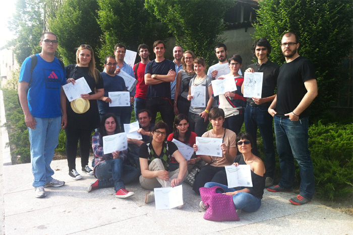
16 participants included students, designers, architects, archaeologists and an agronomist. My favourite story of the day came from the latter, who told me about mapping farmers’ fields for the government. He said it took a long time to figure out why the farmers were so bad at tracing their own fields when presented with maps of the area. It turned out that, because of the passage of the sun, their local knowledge was entirely bound to an East-West axis, rather than the North-South common on regular maps. Turn the maps 90°, and the farmer’s local knowledge snapped into focus.
We mapped a good chunk of the areas of interest, but more importantly, I hope, got a whole new bunch of people interested in open maps and mapping. I’m back in Guimarães in July for another workshop on aerial photography and balloon mapping, and I hope to see how much the map has changed by then.
There are lots of photos of the workshop – including examples of the Walking Papers made – on Flickr.

[…] James Bridle’s presentation of the workshop, instructions on how to keep mapping and lots of interesting links on his blog:Â http://booktwo.org/notebook/mapping-workshop-guimaraes/ […]
Pingback by Open City » Maps Created by Everybody — June 1, 2012 @ 1:42 pm