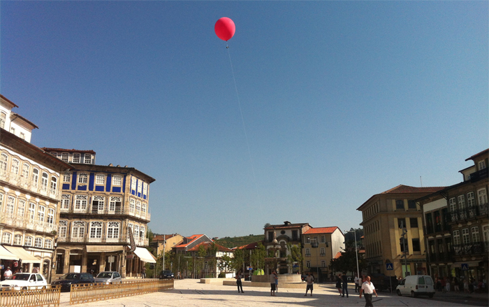
Back in May, I went to Guimarães in Northern Portugal, one of two European Cities of Culture for 2012, to run a workshop on open mapping, in association with Watershed and the Open Cities project. I was back there this week, for another workshop, this time for two days on aerial photography and balloon mapping, hosted by LCD at the wonderful CAAA.
The format was similar: take 15 or so people, tell them a bit about the politics and practice of open mapping, give them the necessary tools (or make them), then set them loose. The results, in this case, were better than I had dared hope for.
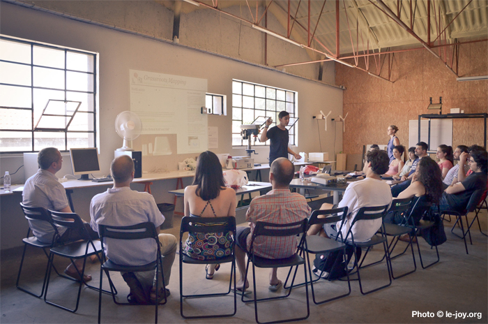
The workshop presentation can be found here. I started by talking about how I got into balloons: trying to take simple aerial photographs with party balloons. This was lots of fun—particularly in terms of the response that wandering around with a big bunch of colourful balloons produces in people, and then the associated interest/confusion in the surveillance implications associated with that. I tried with bigger balloons too—although using multiple balloons makes the whole thing quite unstable, so I realised that single, very large balloons were going to be required.
Then I discovered the Public Laboratory‘s Grassroots Mapping project: open toolkits for aerial mapping. They’ve been used for things like producing community maps of the Gulf oil spill—a very good example of open-source engineering and activism (I’m interested too in using these techniques for documenting protests, as has been done at several Occupy demonstrations.)
The Public Laboratory kickstarted ready-made kits a while ago, but you can also do it yourself quite easily from their instructions.
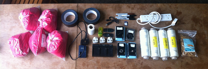
The kit used for this workshop was a variant on Grassroots Mapping’s standard kit, all sourced from hardware stores and the internet. We used 8′ chloroprene ballons from Signature Balloons, and second-hand Canon Powershot cameras from eBay. The Canons are great, because they can be hacked with the open-source CHDK firmware to do a whole bunch more than the off-the-shelf cameras. In this case, we were adding time-lapse (intervalometer) functions to take a photo automatically every 10 seconds while the balloons were in the air. (Top tip, if you’re on a Mac, ACID and SDMinst make this a lot easier, and other apps are available.)
Helium was sourced locally. Helium is great, but there are some issues around it. It’s a finite resource, and it’s needed for medical and scientific research (e.g. MRI scanners and super-cooling the colliders at CERN). The price of helium has gone up significantly in the last few years, not least because of military use in Iraq and Afghanistan. The US sold off a lot of its strategic reserve a few years ago—artificially lowering the price for a while—but is now buying in bulk. I hear helium is also at a premium in the UK at the moment, quite probably because of the Olympics. This trend is likely to continue, but there are few alternatives, with other lighter-than-air gases including hydrogen (highly flammable), neon (heavier and expensive) and ammonia (caustic and poisonous). Personally, I think we should be working on vacuum airships.
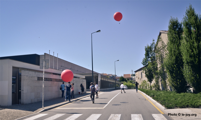
We had three balloons out on the first afternoon, and two on the second (owing to a rather large pop). The balloons were on 110m tethers, which translates to about a 100m x 75m square view of the ground at full extension. We added about a third more gas on the second day, which meant more stability but a lot more work to raise and lower (for next time: proper reels, and gloves).
As before, we wanted to map the Couros area, an old industrial district which is currently being regenerated as part of the City of Culture programme. We covered a number of other areas as well, including the Villa Flor, headquarters of the programme, Toural Square in the centre, and one team, from Demo, a theatre group also taking part in the programme, got some shots of Guimarães’ 10th Century castle (Wikipedia).
Here’s an example shot of the Villa Flor:
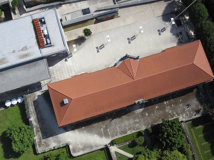
These are 4 megapixel images shot on a cheap compact. As it’s swinging around under a balloon a hundred metres in the air, you get a lot of blurry, out-of-focus and over/underexposed shots, but you get plenty of usable ones too. (You can see the balloon string rising up from one team at the top right; you can also see the second team, whose balloon is out of shot, bottom right. That’s me in the hat.)
The Toural images are special for another reason too. Toural Square is the main square of the city, and was recently redesigned and rebuilt. As of May 2012, Google Earth and other source are still showing the old square, with flowerbeds and a fountain in the middle. Everyone in Guimarães knows it’s been built, and most were aware it had a new design on the cobblestones, but most didn’t know what it was, and certainly hadn’t seen it from the only viewpoint from which you can really make sense of it—the sky:
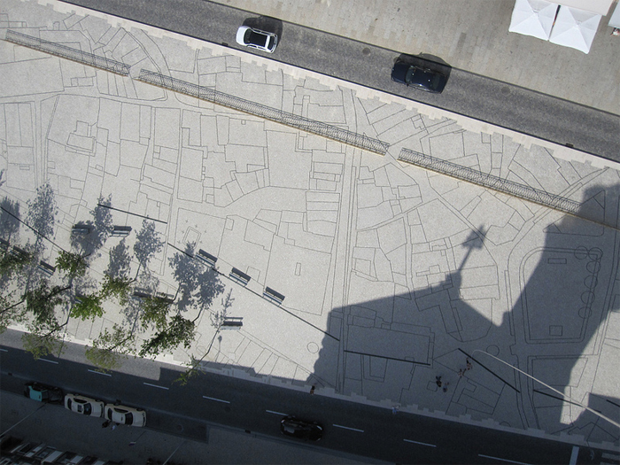
We collected several hundred images over the two days, and as this was a public workshop on open mapping, these are all in the public domain. I especially hope the participants who shot them want them, but they’re open to all, and can be downloaded here (for the moment):
- Team 1, Day One [582 MB]
- Team 2, Day One [1.4 GB]
- Team 3, Day One [448 MB]
- Team 1, Day Two [825.4 MB]
- Team 2, Day Two [1.25 GB]
There are also a bunch of images on Flickr, and on the workshop Facebook page.
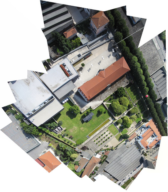
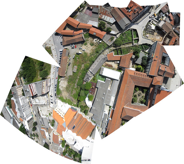
In addition to the kits, the Public Laboratory has created some great open-source tools for verifying images and collating them into maps: MapMill and Mapknitter. I’ve cheated a bit here, and used Photoshop’s Photomerge function to quickly stitch images of Toural and the old city, the Villa Flor, and the Couros district into huge, high-definition aerial maps (follow the links to view these larger on Flickr):
These images aren’t truly rectified in the way satellite images are: because of the altitude and occasionally wild angles of the cameras, you get some pretty crazy perspective effects. But they are still pretty stunning (and those effects remind me strongly of this David Hockney lecture on looking and perspective, via BERG’s Here and There map).
The end result of the workshop is a great repository of new, up-to-date and public domain aerial images of Guimarães, at a higher definition than most commercial services. You’ve also got a bunch of people thinking about open mapping, public mapping, and the politics thereof, with the tools and skills to do it again, for themselves. There’s already talk of mapping some of Portugal’s smaller, even abandoned, villages, using the same techniques. An additional advantage of using the balloons is spectacle: we got a lot of passers-by interested and informed too. Walking around with eight-foot red balloons does get people’s attention.
Thanks to everyone at Watershed, LCD, CAAA, Guimarães 2012 and particularly to all of the participants for making this possible. If you’d like more information, or indeed if you’d like to know more about doing a workshop, do get in touch.

Comments are closed. Feel free to email if you have something to say, or leave a trackback from your own site.